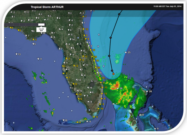
WeatherFlow Captures July 4th Winds From Hurricane Arthur
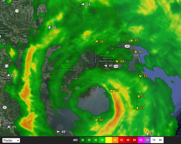
Poquoson, VA – WeatherFlow’s network of weather stations captured the passage the nation’s first hurricane since Superstorm Sandy. Hurricane Arthur made landfall near Fort Macon, NC and passed through the Outer Banks of North Carolina exhibiting surface wind speeds of a Category 1 tropical storm on the Saffir-Simpson Hurricane Scale. The dense network of weather […]
WeatherFlow Captures July 4th Winds From Hurricane Arthur Read More »