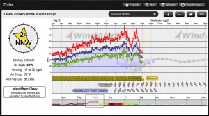
 Hurricane Isaac brushed past the Florida Keys then moved ashore into the Louisiana coast. WeatherFlow’s coastal network performed impressively through the duration of the storm. WeatherFlow’s hurricane network reported a 100% uptime to record some impressive data.
– WeatherFlow’s station at Smith Shoal Light (7miles NW of of Key West) stayed on line while all other over water sensors in the area went off line. The National Weather Service and National Hurricane Center relied heavily on this station.
– 5 WeatherFlow Hurricane Stations captured sustained Tropical Storm Force winds.
– The National Weather Service in New Orleans used WeatherFlow data as was shown in their Post-Storm Analyis.
WeatherFlow Hurricane Network Maximum winds for Hurricane Isaac:
| Name | Max avg (mph) | Max Gust (mph) | State | Time of Max Avg | Time of Max Gust |
| Lakefront Airport | 66.4 | 84.4 | LA | 8/29/2012 1:00 | 8/29/2012 0:05 |
| Dulac | 56.2 | 73.2 | LA | 8/29/2012 6:43 | 8/29/2012 4:05 |
| Jefferson Parish | 54.8 | 70.7 | LA | 8/29/2012 5:25 | 8/29/2012 4:10 |
| Gulfport | 55 | 67.1 | MS | 8/29/2012 12:36 | 8/29/2012 12:10 |
| Mandeville | 53.7 | 66 | LA | 8/29/2012 16:56 | 8/29/2012 15:15 |
