
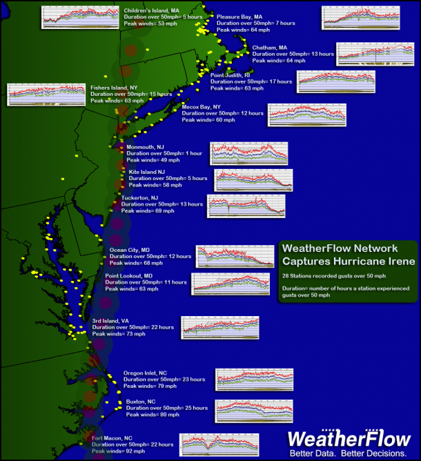
WeatherFlow Network Captures Hurricane Irene Footprint
Hurricane Irene registered tropical storm force winds over a greater geographic area than any storm in…
WeatherFlow Network Captures Hurricane Irene Footprint Read More »
Hurricane Irene registered tropical storm force winds over a greater geographic area than any storm in…
WeatherFlow Network Captures Hurricane Irene Footprint Read More »
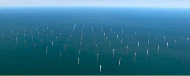
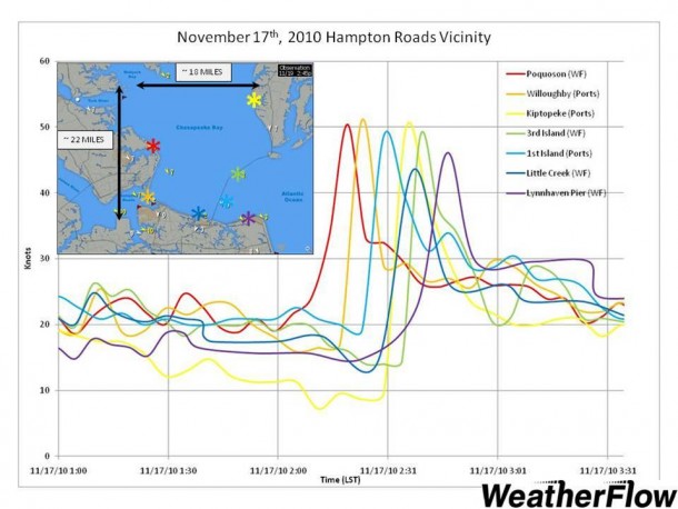
August 30, 2011. Poquoson, Virginia. Meteorologists from WeatherFlow’s Virginia office recently began a pair of intensive studies of the wind conditions found along the North Carolina and Virginia coastlines. Although funded by different sources and sponsors, the projects are employing similar methodologies and are building on the lessons learned provided by each. For the studies,
Middle Atlantic Offshore Wind Energy Studies Read More »
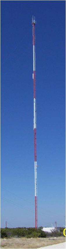
More than twenty years of real world lessons learned are being brought to bear in WeatherFlow’s Bolton office, as…
Tall Tower Wind Monitoring Technology Developed Read More »
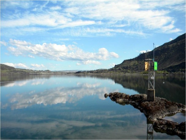
November 3, 2010. Columbia River Gorge, Oregon. WeatherFlow installed 3 new sites along the Columbia River Gorge during the 2nd half of 2010 and is making plans to add two more during the 1st half of 2011. These new sites are located near Rowena, Stevenson, and Sauvie’s Island Oregon and are positioned on navigational aids along the river,
New Observing Sites in the Columbia River Gorge Read More »
December 21, 2010. Suitland, Maryland. NOAA/NESDIS researcher Dr. Ken Pryor is using Weatherflow observations to help verify his newly developed microburst forecasting technique, in which he uses GOES Satellite imagery to estimate surface wind speeds emanating from convection. On several recent occasions, WeatherFlow observations have verified the estimates generated by his algorithm. Two such events occurred on
Microburst Research uses WeatherFlow Data Read More »