
Radar is one of the most powerful tools meteorologists use to track and predict weather conditions. But how does radar work, and why is it so essential for forecasting?
When most people think of weather radar, they think of Doppler radar, which measures both the location and movement of weather systems. While radar alone isn’t enough to create a complete weather forecast, it plays a critical role in detecting precipitation, tracking storms, and determining their intensity. In this guide, we’ll explain what radar is, how it works, and why it’s essential for weather forecasting.
The Tempest Weather System provides hyper-local weather forecasts using real-time data, helping you stay informed no matter the conditions.
What Is Doppler Radar?
Radar stands for “Radio Detection and Ranging.” It works by transmitting radio waves and measuring the time it takes for them to bounce back after hitting an object. This allows them to determine the location, movement, and intensity of weather systems.
There are two types of radar:
- Standard Radar: Measures the location of objects, commonly used for aviation and terrain detection.
- Doppler Radar: Measures both the location and velocity of an object, helping meteorologists track storms and determine wind speeds.
Doppler radar is crucial for weather forecasting because it can detect motion within a storm system. It helps identify wind patterns, storm intensity, and potential severe weather, making it an invaluable tool for tracking everything from light rain to hurricanes.
How Does Doppler Radar Work?
Radars operate by emitting radio waves that travel through the atmosphere and bounce off objects like clouds and precipitation. They then analyze the returning signals to determine:
- The location and movement of a storm
- The amount and type of precipitation (rain, snow, hail, etc.)
- The size and velocity of raindrops or snowflakes
- The storm’s direction and potential changes in intensity
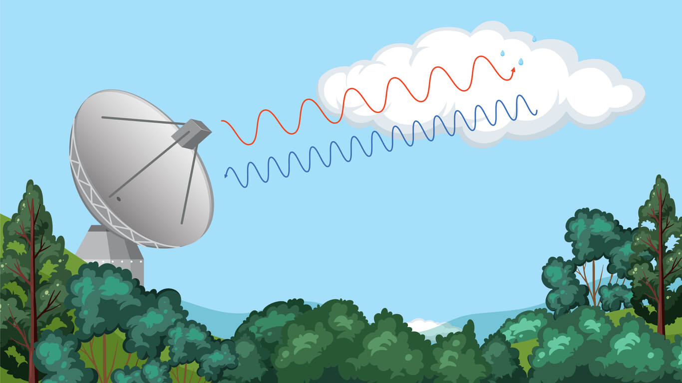
When a storm moves toward the radar, the returning wavelengths are shorter, a phenomenon known as the Doppler effect. When a storm moves away from the radar, the wavelengths lengthen. This shift in wavelength helps meteorologists understand wind speeds and rotational movement, which is critical for identifying tornadoes or dangerous wind shear. Radar technology allows meteorologists to “see” inside storms, providing valuable information long before severe weather reaches the ground.
Want to learn more about weather forecasts? Discover what rain percentage means and how it helps you plan your day.
Radar Interferences
While radar is a highly reliable tool, it isn’t always 100% accurate. Various factors can interfere with its signals, leading to incomplete or distorted data. Some common sources of interference include:
- Terrain and buildings: Mountains, hills, and tall buildings can block or weaken radar signals.
- Heavy precipitation: Intense rainfall or hail can cause radar beams to scatter, making it harder to measure storm details accurately.
- False echoes: Radar waves sometimes bounce off non-weather objects, such as birds, aircraft, or even large bodies of water, leading to misleading data.
To correct these inaccuracies, meteorologists combine radar data with satellite imagery, weather balloons, and ground-based weather stations. This ensures that forecasts remain as accurate as possible, even when radar interference occurs.
How Is Radar Used To Forecast Weather?
Radar is essential for short-term weather forecasting and severe weather detection. It helps meteorologists analyze:
- Precipitation patterns: Radar can detect where rain or snow is falling and how much is expected.
- Storm movement: Tracking how fast and in what direction a storm is moving helps improve forecast accuracy.
- Severe weather alerts: They help identify tornado formations, hurricane strength, and dangerous thunderstorms, allowing authorities to issue timely warnings.
Doppler radar is especially useful for tracking storm rotation, which is critical for identifying tornadoes before they form. It can also detect microbursts (sudden downdrafts of wind) and wind shear, both of which pose risks to aircraft and outdoor activities.
This data is then fed into computer models that predict weather patterns for the next few hours or even days. Combined with real-time temperature, humidity, and wind readings, radar helps meteorologists refine their forecasts to provide the most reliable information possible.
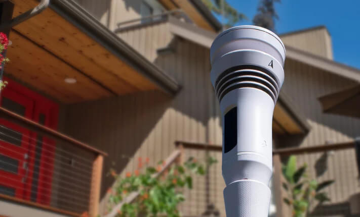
The Tempest Weather Station sends live weather readings straight to your phone, helping you know when you can do your outdoor hobbies like gardening.
What Are The Boxes On Doppler Radars?
When viewing a Doppler radar map, you may notice colored boxes outlining certain areas. These boxes indicate weather alerts issued by the National Weather Service (NWS).
Each color represents a different type of weather alert:
- Red boxes: Tornado watch or warning
- Yellow boxes: Severe thunderstorm watch or warning
- Green boxes: Flash flood watch or warning
These alerts help meteorologists track storms in real-time and provide critical safety information to the public. If a tornado warning or severe thunderstorm warning is issued for your area, take it seriously and seek shelter immediately.
Get Accurate Weather Forecasts With The Tempest Weather System
Doppler radar plays a crucial role in tracking storms and keeping people safe. By using radio waves to measure precipitation, wind speeds, and storm intensity, radar provides valuable insights into approaching weather conditions.
The Tempest Weather System, a personal weather station, enhances weather tracking by combining real-time data from advanced sensors with global weather models. It continuously refines forecasts using AI and machine learning, ensuring more precise predictions. Unlike traditional radar systems, the Tempest Weather System delivers hyper-local weather forecasts, allowing users to receive accurate, location-specific alerts for their area.
Want better weather tracking at home? Shop the Tempest Weather System today and stay ahead of changing conditions.