
Air temperature, wind, and humidity can shift dramatically over short distances, creating unique weather patterns in microclimates. But what is a microclimate?
Microclimates influence everything from how vegetation grows to how comfortable your backyard feels on a summer afternoon. They’re shaped by factors like sunlight, elevation, and nearby water, creating noticeable differences even within a few miles. Our guide explores what causes these variations, where they appear, and how the Tempest Weather System helps reveal them in real time.
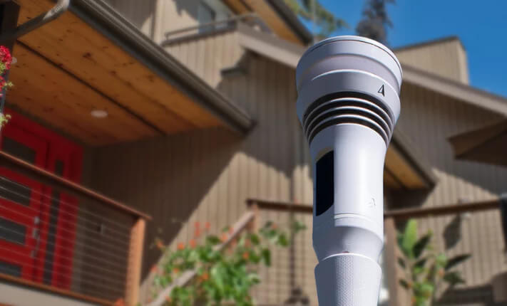
Get hyperlocal weather forecasts with the Tempest Weather System, a personal weather station that sends you real-time data straight from your backyard.
What Are Microclimates?
The definition of a microclimate refers to a small area, such as a garden, valley, or city street, that has its own distinct climate compared to the surrounding area. While regional and global climates cover vast geographic regions, microclimates can span just a few feet or miles.
A common microclimate example occurs in a city where a park can be cooler than a nearby city street due to the presence of trees and grass that provide shade and release moisture. Similarly, there can be several microclimates within a garden. For instance, shaded areas beneath trees tend to stay cooler and moister than areas without trees.
Ever noticed how certain plants in your garden thrive more than others? Find out why in our simplified guide to U.S. gardening zones.
What Causes Microclimates To Form?
Microclimates develop when certain features in a small area create weather patterns that differ from the surrounding region. Common factors that influence the creation of microclimates include:
- Topography: The different terrain and elevation in an area can cause microclimates. For example, people residing in a home on a south-facing slope usually receive more sunlight and experience warmer conditions than people on the north side.
- Vegetation: Areas with dense vegetation, such as tree-filled parks, tend to stay cooler and more humid than heavily developed city spaces. Soil type also plays a role, influencing how much heat and moisture the ground can absorb.
- Bodies of water: Areas near rivers, lakes, or oceans have higher humidity levels than areas far from water sources. They also tend to experience cooler temperatures in summer and higher ones in winter because water warms and cools more slowly than land.
- Human activity: Temperatures in an urban environment tend to be higher than those in the surrounding regions due to human activity. Tall buildings, walls, and other artificial structures often absorb heat, making urban areas hotter than nearby rural areas.
Why do hot temperatures feel different from one city to another? Learn why in our dry heat vs. humid heat guide.
Examples Of A Microclimate
While there’s a distinct microclimate for every type of environment on Earth, some examples of microclimates in the U.S. include the following:
- Urban: Urban regions tend to have diverse microclimates due to human activity that creates urban heat islands. For instance, San Francisco has over 26 microclimates due to its complex topography, proximity to the ocean, and heavy human influence, with temperatures varying as much as 25 degrees Fahrenheit between neighborhoods. These varying temperatures impact energy needs for residents across the city.
- Coastal: Coastal areas often have varying microclimates. For instance, Hawaii’s Big Island has extreme variations in rainfall, with Hilo receiving up to 130 inches of annual rainfall while Kailua-Kona gets just 20-30 inches, despite being only 60 miles apart.
- Mountainous: Mountains create varying microclimates, as they impact air flow. When moist air hits the side of a mountain facing the wind (windward side), it rises and cools, resulting in rainfall. In contrast, on the side that faces away from the wind (leeward side), the air descends the slope, warms, and dries out, leading to drier conditions. This is why some parts of Hawaii are lush and green while others are drier.
- Forested: Forested regions usually have heavier rainfall than surrounding areas. For example, the Olympic National Park tends to receive more rainfall than other nearby areas in Washington due to its temperate rainforests.
What’s the best time to plant or weed? Learn about the best weather for gardening tasks in our comprehensive guide.
Get Accurate Hyperlocal Weather Forecasts With The Tempest Weather System
Many local weather forecasts provide relatively reliable updates about whether it will rain or shine in an area, but they can’t take all microclimates into account. This makes them unsuitable for planning outdoor activities or determining the soil moisture levels in your garden.
Want to get exceptionally accurate weather forecasts for your area? The Tempest Weather System provides precise, real-time data on temperature and humidity, allowing you to reduce your dependence on unreliable weather reports.
Take the guesswork out of local weather forecasting. Get the Tempest Weather System and plan every day with certainty!