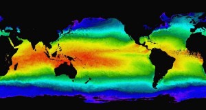
 For those operating in the coastal zone, water conditions are often of equal or greater importance than weather conditions. Factors like wave height, water temperature, and currents can have a major impact, whether it’s a Coast Guard cutter conducting a search and rescue, a workboat Captain deciding whether it is safe to put his crew on deck, or a family deciding whether it is a good day for a fishing outing.
Of course the ocean and atmosphere impact each other greatly, and WeatherFlow actively seeks to incorporate oceanographic data wherever possible. For a selected set of our weather stations, this means adding oceanographic sensors (water column temperature, sea surface temperature, current meters and profilers) to better characterize the local conditions. We are also working aggressively with NOAA’s Integrated Oceanographic Observing System (IOOS) program and other partners to access and incorporate new observational data sources, including High Frequency Radar data to measure nearshore surface currents and wave heights in selected locations along the U.S. coastline.
In 2011, we have improved our use of oceanographic data, accessing improved Sea Surface Temperature data sets and, for the first time, providing access to data from NOAA’s Wave Watch 3 (WW3) wave height model.